GR-4 Review: Groundtech’s Compact 3D Ground Scanner for Underground Anomaly Detection

What Is the Groundtech GR-4?
The Groundtech GR-4 is a portable 3D ground scanner from Groundtech Detectors. It is designed to detect and evaluate underground anomalies using dual sensor technology and software-based visual analysis. The manufacturer positions it as a practical and versatile device for professional treasure hunters, archaeological treasure seekers, and users investigating underground structures.
In the Groundtech product lineup, the GR-4 sits as a compact 3D scanning system, while the GR-4 DUAL adds an integrated pulse induction detector system. This review focuses on the standard GR-4. That distinction matters because the standard GR-4 is not listed with the dedicated PI detector system found in the DUAL version. Its role is ground scanning, live scanning, pinpointer-style location support, and 3D analysis through the device screen and G-Portal app.
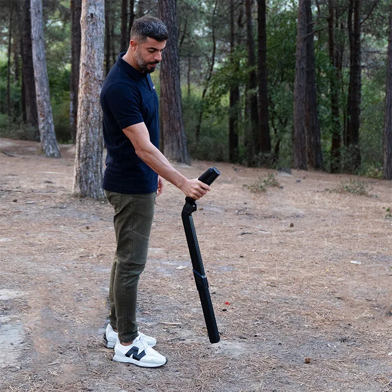
The GR-4 is designed for portability. Groundtech emphasizes a simplified, compact design, a foldable modular body, adjustable grip angle, and removable sensor module. In field terms, this makes the device easier to transport and deploy than many older 3D scanning systems. A detector that is too awkward to carry often stays in the vehicle. The GR-4’s compact design is part of its appeal.
GR4 Review: Quick Verdict
The GR-4 is best suited to users who want a compact 3D ground scanner for anomaly detection, cavity search, buried metal assessment, and visual scan analysis. Its strongest advantages are simplicity, portability, multilingual support, integrated screen operation, mobile app analysis, MFS-2 dual sensor technology, and a useful set of scan modes for quick and deeper investigation.
It is especially interesting for users who want to detect more than surface metals. The GR-4 can help investigate magnetic and non-magnetic responses, underground void-like structures, tunnels, rooms, graves, and buried objects. The Groundtech Portal software can present results in colored graphics, helping users understand scan patterns more clearly than audio-only detection.
The main limitation is that the standard GR-4 is primarily a scanner, not the same as the GR-4 DUAL with integrated pulse induction metal detection. If a buyer wants both 3D ground scanning and a dedicated PI detector system in one unit, the DUAL version is the more complete device. If the buyer’s main goal is lightweight 3D scanning, fast live feedback, and mobile analysis, the standard GR-4 is the more focused choice.
Key Technology: MFS-2 Dual Sensor System
The core of the GR-4 is Groundtech’s MFS-2 Dual Sensor Technology. Groundtech describes it as a high-sensitivity dual sensor system that allows more sensitive and deeper scanning while minimizing error margin. The official comparison table lists the GR-4 sensor technology as MFS-2 Dual Sensor Technology, a gradiometer rated at plus or minus 2000 microtesla.
A gradiometer-style sensor system is used to measure magnetic differences across space. In underground scanning, that can help identify anomalies caused by buried metal, magnetic objects, disturbed ground, voids, and structural differences. The dual sensor concept improves the scanner’s ability to compare changes rather than relying on a single point of measurement.
For users, the technical value is clearer visual data. Instead of listening only for a tone, the GR-4 collects sensor readings and converts them into graphical results. This can help users identify whether a scan line has unusual high or low responses, whether a suspected object has shape, and whether repeated scans show a consistent anomaly.
However, sensor data must be interpreted carefully. Soil mineralization, surface trash, buried iron, operator movement, and scan spacing can all affect results. MFS-2 technology gives the device a strong sensor base, but the operator still needs disciplined scanning technique.
Specifications Table
| Specification | Groundtech GR-4 Details |
|---|---|
| Product name | Groundtech GR-4 |
| System type | 3D ground scanner |
| Sensor technology | MFS-2 Dual Sensor Technology, gradiometer plus or minus 2000 microtesla |
| Detector technology | No dedicated pulse induction detector system in the standard GR-4 |
| Processor | 240 MHz CPU with 12-bit A/D converter |
| 3D scanning depth | Up to 15 meters depending on soil, target size, and scanning mode |
| Scanning modes | 3D Ground Scanning, Live Scanning, Pinpointer |
| Analysis app | G-Portal Android and iOS 3D/4D Analysis Program |
| Device languages | 11 languages |
| Mobile app languages | 25 languages |
| Battery | 3.7 V Li-ion rechargeable battery |
| Operating time | Approximately 10 hours for the 3D scanning system |
| Wireless connection | Bluetooth 4.2 BLE |
| Operating temperature | 0°C to 70°C |
| Storage conditions | -20°C to 60°C |
| Charging | USB Type-C, 25 W charger adapter |
| Warranty | 2 years |
| Package content | Main unit, carrying bag, user manual, charging adapter, MFS-2 Dual Sensor |
Design and Field Handling
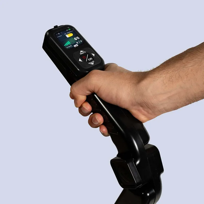
The GR-4’s design is one of its biggest practical advantages. Groundtech describes it as simple, compact, foldable, modular, and accessible. It includes an integrated high-resolution color display, meaning the device can operate independently without always requiring a phone or tablet. This is important because field users may not want to depend on a separate mobile screen in dust, heat, bright sunlight, or rough terrain.
The foldable modular body and adjustable grip angle make the GR-4 easier to adapt to different users and field conditions. A removable sensor module also helps with transport and maintenance. In comparison with older bulky 3D scanners, the GR-4 feels like a more modern field tool designed around portability.
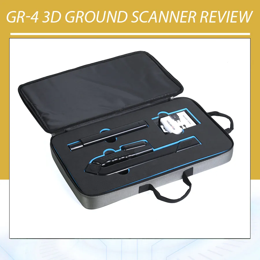
Groundtech’s package content is straightforward: main unit, carrying bag, user manual, charging adapter, and MFS-2 Dual Sensor. This makes the product understandable for buyers. There is not a long list of confusing antenna choices or optional sensor modules required for basic operation. The GR-4 is designed as a compact scanning package.
Scanning Modes Explained
3D Ground Scanning
3D Ground Scanning is the main mode for structured underground analysis. In this mode, the user scans an area in a controlled pattern and evaluates the data through the device and G-Portal app. This is the mode most relevant for users who want to investigate buried metals, magnetic objects, voids, graves, rooms, or tunnels.
Good 3D scanning requires discipline. The user should choose a scan area, maintain consistent lines, avoid random movement, and repeat suspicious results. A scan that is rushed or uneven may produce a colorful result, but that does not mean it is reliable. The GR-4’s software can help visualize anomalies, but the operator creates the data quality.
Live Scanning
Live Scanning is intended for quick graphical detection of underground objects without being tied to a strict search pattern. This is useful when the operator wants immediate feedback while moving over an area. It can help identify zones worth further investigation before performing a more structured 3D scan.
Live Scanning is practical because many search sites are uncertain. The user may not know where to start. A quick live pass can help narrow the area, then the 3D Ground Scanning mode can be used for more detailed analysis.
Pinpointer Function
The Pinpointer Function helps locate the position of detected objects more precisely. In a visual scanner, pinpointing is useful after a wider scan indicates an anomaly. The user can then focus on the strongest or most consistent response and mark the likely target zone.
Pinpointing should not be confused with exact target identification. It helps narrow location, but excavation decisions should still consider scan consistency, target depth estimate, surrounding ground, and repeated passes.
G-Portal App and 3D/4D Analysis
The GR-4 works with Groundtech Portal, also called G-Portal, an Android and iOS application developed for 3D and 4D analysis. Groundtech says users can save scan data, examine 3D and 4D analyses in more detail, and generate comprehensive reports. This combination of standalone device operation and mobile analysis is one of the GR-4’s strongest features.
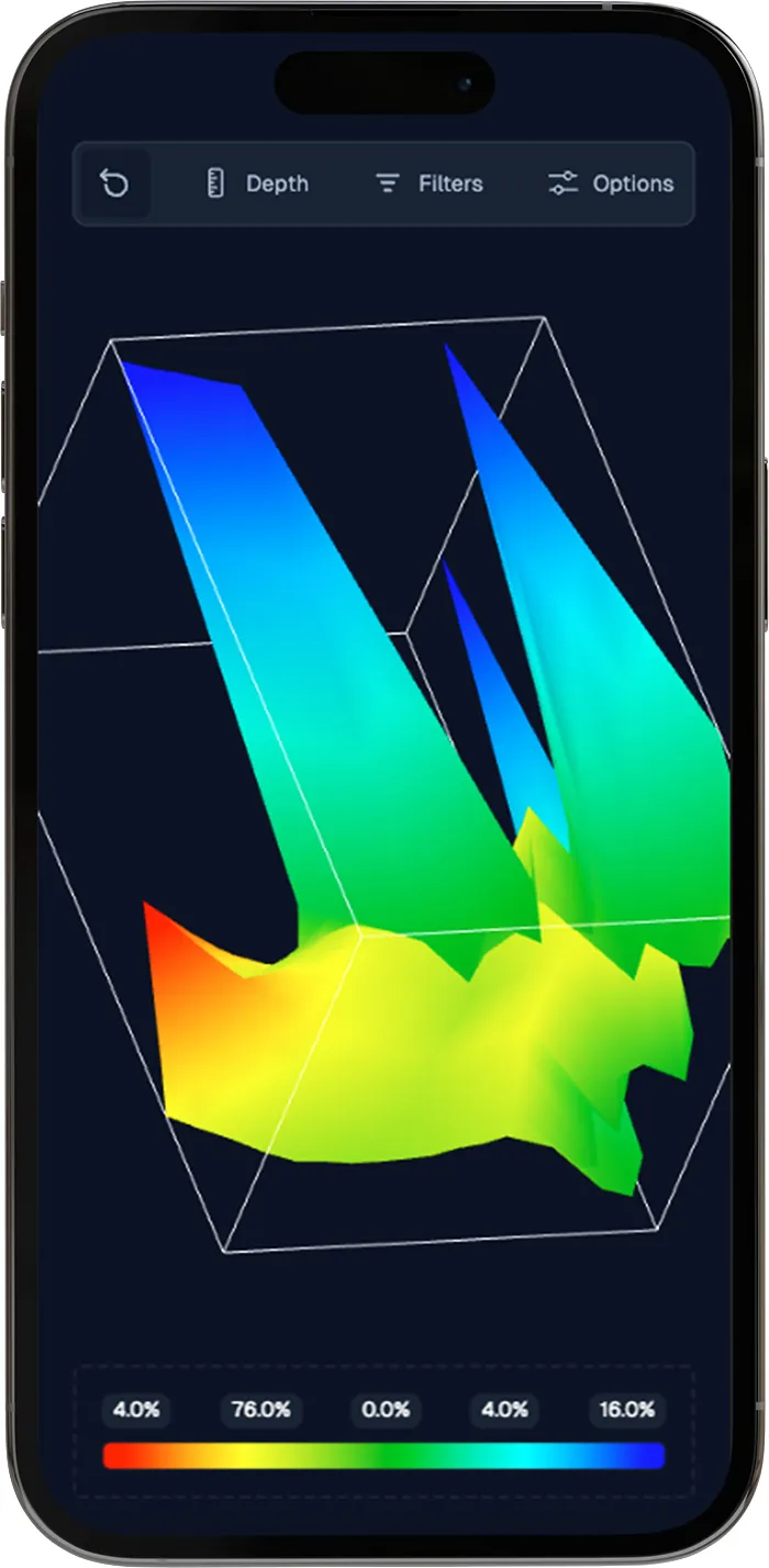
The integrated screen gives fast use in the field, while the app provides more detailed study. That matters because not every scan should be judged immediately. A user may need to compare multiple scans, rotate a 3D result, review depth views, and decide whether an anomaly is worth verifying. Reports can also be useful for professional users who document search areas for clients or teams.
Groundtech’s website explains that scanning results can be viewed as 3D colored graphics, with metals, spaces, structures, and differences identified through different color ranges. This visual presentation is easier for many users than raw numbers. Still, colors should be treated as interpretation aids, not absolute proof. Every ground scanner needs verification.
Depth Capability: What Does “Up to 15 Meters” Mean?
Groundtech lists the GR-4 3D scanning depth as up to 15 meters. The manufacturer also adds that depth varies depending on soil structure, object size, and scanning function. This warning is important and should be part of any honest GR4 Review.
A large buried room, tunnel, or major metal object is easier to detect at depth than a small object. Dry, low-conductive soil is usually better for scanning than wet, highly mineralized, or salty soil. Flat, clean ground is easier to scan than rocky or uneven ground. Operator technique also matters: consistent movement, correct scan direction, and repeated confirmation can improve reliability.
The best way to understand GR-4 depth is to think in categories. For near-surface anomalies, the device can provide fast visual feedback. For deeper targets, the anomaly must be large enough and different enough from the surrounding ground. For maximum depth, conditions must be favorable. The GR-4’s “up to 15 meters” statement should not be interpreted as a guaranteed depth for every target.
Target Types and Use Cases
The GR-4 is suitable for several target categories. Groundtech specifically mentions buried metals, magnetic objects, graves, rooms, and cavities such as tunnels. The device can graphically show magnetic metals such as iron or steel and non-magnetic metals such as gold, silver, or copper through the Groundtech Portal software.
For treasure hunters, the GR-4 is most useful when searching for larger buried anomalies rather than tiny individual items. It can help identify suspicious ground zones, possible cavities, and metal responses that deserve verification. It is not a replacement for every metal detector. For small coins or tiny gold nuggets, a dedicated coil detector is still more direct.
For archaeological search users, the GR-4 can help investigate graves, rooms, tunnels, and buried structures without immediately digging. Non-invasive scanning can save time and reduce unnecessary disturbance. For professional projects, scan reports from G-Portal may help document results.
For landowners or technical users, the GR-4 may help investigate underground anomalies before digging. However, it should not replace professional utility locating when safety-critical cables, gas lines, or electrical infrastructure may be present. It can be a useful investigation tool, but legal and safety procedures still matter.
GR-4 vs GR-4 DUAL
The standard GR-4 and GR-4 DUAL share several core features: MFS-2 Dual Sensor Technology, 240 MHz CPU, 12-bit A/D converter, G-Portal app, multilingual support, Bluetooth 4.2 BLE, 3.7 V Li-ion battery, 0°C to 70°C operating temperature, and 2-year warranty. The main difference is detector technology.
The GR-4 is listed as a 3D ground scanner. The GR-4 DUAL is listed as a 3D ground scanner plus integrated pulse induction metal detector. The DUAL version adds Pulse Induction Technology at 1 kHz and includes Detector Fast Scanning and Detector Advanced Scanning modes. Groundtech lists the DUAL detector system depth as up to 3 meters, while both models share the up to 15-meter 3D scanning depth claim.
In practical terms, choose the GR-4 if your main goal is compact 3D scanning and visual anomaly analysis. Choose the GR-4 DUAL if you also want a built-in pulse induction detector for more direct metal detection in the same device. This review focuses on the standard GR-4, but buyers should compare both models carefully before purchase.
Firmware and Software Support
Groundtech provides a firmware updater for the GR-4. The official firmware update page mentions improvements such as better operation in sub-zero temperatures, enhanced 3D MFS visualization, and optimized PI detection percentage values. The PI-specific note is more relevant to the DUAL system, but the update page shows that Groundtech actively maintains the GR-4 platform.
Firmware support is important in modern detectors and scanners because many functions depend on software interpretation. Improved visualization can make scan results more stable. Better cold-weather behavior matters for field users in winter climates or high-altitude environments. Buyers should keep firmware current, but updates should be performed carefully with a stable USB Type-C connection and enough time to complete the process.
Ease of Use and Languages
Groundtech emphasizes multi-language support. The GR-4 device supports 11 languages, while the mobile app supports 25 languages. The product page lists languages such as English, German, Spanish, Italian, French, Turkish, Russian, Chinese, Arabic, and Persian. This is valuable for international users and distributors.
Ease of use is also supported by the integrated display. Users can view scanning modes, settings, and results directly on the device. This reduces dependence on a phone or tablet in quick field work. If more advanced analysis is needed, the G-Portal app can be used later or alongside the device.
Even so, the GR-4 should be learned systematically. Users should practice in a known area, test metal and void-like examples where possible, learn the color logic, and compare repeated scans. The device is accessible, but serious results still require training.
Pros and Cons
| Pros | Cons |
|---|---|
| Compact 3D ground scanner with modern portable design | Standard GR-4 does not include the integrated PI detector system of the DUAL version |
| MFS-2 Dual Sensor Technology supports magnetic anomaly detection | Depth depends strongly on soil, target size, and scanning method |
| Integrated color screen allows standalone operation | Visual results still require interpretation and verification |
| G-Portal app provides Android and iOS 3D/4D analysis | Not ideal as a direct small-nugget or coin detector |
| Strong multilingual support for international users | Best results require controlled scanning, not random walking |
| Approximately 10 hours of 3D scanning operating time | Maximum 15-meter depth should be treated as conditional |
Who Should Buy the GR-4?
The GR-4 is best for users who want a lightweight 3D scanner for underground anomaly detection. Serious treasure hunters, archaeology-focused users, field researchers, and buyers who want visual scan data can benefit from its combination of sensor technology and app analysis.
It is also suitable for users who prefer a simpler device than older complex scanners. The integrated screen, compact body, and mobile app workflow make the GR-4 approachable. If you want to scan a field, review graphics, save data, and produce reports, the GR-4 fits that workflow.
It is less suitable for users whose main need is direct metal detection with a coil. If you want fast detection of small coins, jewelry, or nuggets, a dedicated metal detector is better. If you want both 3D scanning and pulse induction metal detection in one Groundtech unit, the GR-4 DUAL is the more complete choice.
Frequently Asked Questions
Is the GR-4 a metal detector or ground scanner?
The GR-4 is primarily a 3D ground scanner. It can help identify buried metals and underground anomalies through sensor data and visual analysis, but it is not the same as a dedicated pulse induction metal detector.
What is the focus of this GR4 Review?
This GR4 Review focuses on the standard Groundtech GR-4 model, including its MFS-2 dual sensor system, 3D scanning, live scanning, pinpointer function, G-Portal app, depth capability, strengths, and limitations.
How deep can the GR-4 scan?
Groundtech lists the 3D scanning depth as up to 15 meters. This depends on soil structure, target size, and scanning function, so it should not be treated as a guaranteed depth for every object.
Does the GR-4 work without a phone?
Yes. Groundtech states that the GR-4 can operate independently with its built-in color screen. The G-Portal mobile app is used when the user wants to save scan data, examine more detailed 3D and 4D analysis, or generate reports.
What is the difference between GR-4 and GR-4 DUAL?
The GR-4 is a 3D ground scanner. The GR-4 DUAL adds an integrated pulse induction metal detector system at 1 kHz and includes additional detector scanning modes.
Is the GR-4 suitable for beginners?
The GR-4 is more accessible than many older scanning systems, but beginners still need practice. Good results depend on controlled scanning, understanding color graphics, and verifying repeated anomalies.
Final GR4 Review Verdict
This GR4 Review finds the Groundtech GR-4 to be a compact, modern, and practical 3D ground scanner for users who want visual underground analysis without carrying a heavy survey system. Its MFS-2 dual sensor technology, integrated screen, G-Portal app, live scanning, pinpointer support, multilingual interface, and long 3D scanning battery life make it a strong option in the portable scanner category.
The GR-4 should be purchased with the right expectations. It is not a magic underground camera, and it is not the same as the GR-4 DUAL with pulse induction metal detection. It is a 3D scanning detector that helps users detect, measure, and evaluate underground anomalies. Its value depends on disciplined scanning, soil conditions, target size, and careful interpretation.
For treasure hunters, archaeology users, and field search teams who want a compact scanner with modern software support, the GR-4 is a serious device worth considering. For users who mainly want direct metal detection, small gold prospecting, or fast coin hunting, a standard detector or the GR-4 DUAL may be a better fit. The GR-4 is strongest when used as intended: a portable 3D ground scanner for visual underground exploration.