How to Use GR-4 DUAL for Cavities, Voids, and Buried Treasures
The GR-4 DUAL, also known in product listings as GR-4 GroundTech, is a 3D ground scanning system designed for users who need visual information about what may be hidden below the surface. Unlike a standard audio metal detector that mainly gives a tone when the search coil passes over a target, GR-4 is built to help users analyze underground anomalies such as metal masses, buried treasures, cavities, voids, tunnels, chambers, and soil disturbances.
According to the GR-4 GroundTech product page on Orient Detectors, the device uses MFS-2 technology, supports 3D Ground Scan and Live Scan modes, works through a dedicated Android/iOS application, and is designed to generate 3D graphical imaging with color-coded visual results. This guide explains how to use GR-4 DUAL in a practical field workflow, with special attention to cavities, voids, and buried treasures.
What GR-4 DUAL Is Designed to Do
GR-4 DUAL is best understood as a ground scanner, not a simple “beep and dig” detector. Its value comes from scanning an area and helping the operator visualize changes below the surface. These changes may be caused by metal objects, treasure containers, buried structures, cavities, empty spaces, disturbed soil, or geological differences. Because the system provides imaging, the operator must learn how to scan correctly and interpret results carefully.
The device is especially useful when the search question is not “Is there a coin under this coil?” but rather “Is there an underground anomaly in this area, and does it look like a metal target, void, cavity, or disturbed structure?” That difference matters. GR-4 DUAL should be used with a systematic scan plan, not random walking.
Key GR-4 DUAL Search Concepts
| Concept | Meaning | Practical Use |
|---|---|---|
| 3D Ground Scan | Structured scan that creates a visual model | Best for mapped analysis of a search area |
| Live Scan | Real-time response while moving | Useful for checking anomalies quickly |
| MFS-2 sensor | High-performance scanning sensor | Collects ground data for metals and voids |
| Mobile app | Android/iOS control and visualization | Displays, saves, and reviews scan results |
| Color-coded results | Visual separation of metals, voids, and ground structures | Helps interpret target type and shape |
Before You Start: Choose the Right Site
A good scan begins before turning the device on. Choose an area that is legal, safe, and realistic. Avoid scanning near vehicles, fences, power lines, reinforced concrete, large surface metal, underground pipes, and modern trash. If the ground is full of scattered metal debris, scan results may become confusing. If possible, remove obvious surface metal before starting.
For cavities and voids, look for surface clues: depressions, old stone alignments, abandoned wells, collapsed ground, unusual vegetation, historic paths, or visible soil differences. For buried treasures, look for context: old paths, settlement remains, walls, courtyards, or areas where human activity may have occurred. The GR-4 DUAL can help analyze a suspicious area, but good site selection still matters.
Step 1: Prepare the Scan Area
Mark a rectangular area before scanning. This can be done with small flags, stones, ropes, or visible ground marks. A clean grid is essential for meaningful 3D results. Beginners often scan randomly and then wonder why the image looks chaotic. A ground scanner needs structured movement.
Choose a manageable scan size first. A small clean scan is better than a large messy scan. For example, start with a 5 x 5 meter area or smaller if the terrain is difficult. If an anomaly appears near the edge, expand the scan later.
Step 2: Set Up the Device and App
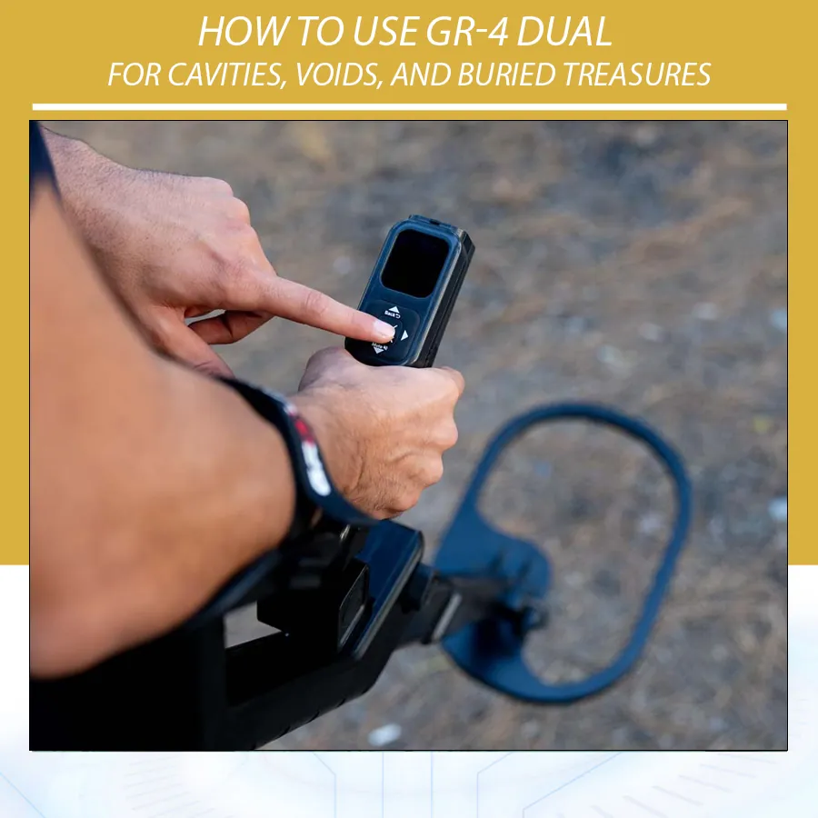
Assemble the GR-4 DUAL according to the manual. Attach the MFS-2 sensor, handle, and control unit securely. Make sure cables are connected properly and the battery is charged. Open the dedicated GR-4 app on a compatible Android or iOS device. Confirm the connection before walking to the start point.
In the app, create a new scan file with a clear name. Use names that make sense later, such as “site-a-north-south-01” or “old-wall-area-3d-scan.” Add notes if the app allows it. If not, keep a separate field notebook with scan direction, soil type, scan size, weather, and visible site features.
Step 3: Select the Correct Scan Mode
Use 3D Ground Scan when you want a mapped image of an area. This is the best mode for serious analysis of cavities, voids, and buried treasures. Use Live Scan when you want a quick real-time check or when you want to pass over a suspicious zone after a 3D scan.
For professional work, do not rely on Live Scan alone. Live response is useful, but a structured 3D scan gives better evidence because you can review shape, size, direction, and repeatability.
Step 4: Walk the Scan Correctly
Keep your movement slow and consistent. Walk straight lines. Maintain a constant sensor height and orientation. Avoid turning your body sharply during a line. At the end of each scan line, move to the next line and continue in the selected pattern. If your steps are uneven, your scan model may distort.
For cavities and voids, consistency matters even more because the result may depend on subtle ground differences. A careless scan can create artificial shapes that look like underground anomalies. The operator must become part of the measurement system: steady, repeatable, and patient.
Step 5: Read the Results Carefully
GR-4 DUAL results should be interpreted as evidence, not automatic proof. A color-coded 3D image can suggest metals, cavities, or disturbed ground, but it must be studied. Ask these questions:
- Is the anomaly compact or random?
- Does it appear in the center of the scan or only at the edge?
- Does it have a logical shape?
- Does the depth estimate make sense?
- Does it repeat when scanning from another direction?
- Is the surface context consistent with the scan result?
Interpreting Cavities and Voids
A cavity or void often appears as a negative or low-density anomaly compared with the surrounding ground. Depending on the app’s color logic and settings, it may appear in colors associated with empty space, lower density, or structural gaps. The key is not color alone but shape and repeatability. A real cavity often has a defined zone, direction, or volume. Random color noise is not enough.
For tunnels, look for elongated shapes. For chambers, look for compact but larger shapes. For small voids, look for localized low-density areas. If a possible cavity appears, repeat the scan from another direction. If the shape remains similar, confidence increases. If it disappears or moves dramatically, the first scan may have been distorted by technique or ground variation.
Interpreting Buried Treasures and Metal Targets
Metal targets often produce stronger, more concentrated responses than cavities. A buried treasure container, metal box, or metallic mass may appear as a compact anomaly with higher intensity. However, large iron trash, pipes, reinforced debris, and modern metal can also produce strong results. Do not assume every strong metal response is treasure.
Use context. A compact metal-like anomaly in a logical historical location is more interesting than a similar response next to a modern fence or vehicle path. Confirm with another scan direction and, if available, a separate metal detector. For final decisions, combine imaging with repeatable direct detection.
3D Scan vs Live Scan: When to Use Each
| Use Case | Best Mode | Reason |
|---|---|---|
| Mapping a suspected chamber | 3D Ground Scan | Gives shape and location data |
| Checking a possible tunnel line | 3D Ground Scan + Live Scan | Map first, then trace response |
| Quick site check | Live Scan | Faster but less complete |
| Buried metal mass | 3D Ground Scan | Better visual confirmation |
| Rechecking a scan anomaly | Live Scan | Useful as secondary confirmation |
Common Mistakes With GR-4 DUAL
Scanning too large an area too soon
Beginners often choose a large area because they want fast results. Large scans are harder to control. Start small, learn the device, then expand.
Changing speed and sensor height
Uneven walking creates unreliable images. Keep the sensor height and movement consistent.
Reading color without shape
Color matters, but shape, position, depth, and repeatability matter more.
Ignoring surface metal
Modern metal debris can create misleading responses. Clear obvious surface targets first.
Digging after one scan
One scan is not enough for important decisions. Repeat and confirm.
Professional Confirmation Workflow
- Mark the area and perform a clean 3D scan.
- Review the scan without heavy filtering first.
- Identify compact or structured anomalies.
- Repeat the scan from another direction.
- Use Live Scan over the suspected area.
- Use a separate metal detector if metal is suspected.
- Expand the grid if the anomaly is near the edge.
- Only consider excavation after legal, safety, and technical confirmation.
Field Notes Template
| Field Note | What to Record |
|---|---|
| Site name | Clear location label |
| Scan direction | North-south, east-west, or custom |
| Scan size | Length, width, number of lines |
| Ground condition | Rocky, wet, dry, mineralized, disturbed |
| Visible features | Walls, depressions, old paths, surface metal |
| Anomaly type | Metal-like, void-like, unclear, edge response |
| Next action | Repeat scan, expand grid, confirm with detector |
Safety and Responsible Use
Cavities, voids, tunnels, and buried structures can be dangerous. A scanner may suggest a void, but it cannot guarantee that the ground is safe. Do not dig into suspected cavities without proper precautions. Follow local laws, obtain permission, and avoid archaeological or protected sites unless you have legal authorization.
How to Build Confidence in a GR-4 DUAL Result
A reliable GR-4 DUAL result usually has several supporting clues. The first clue is structure: the anomaly should look like something, not random color noise. The second clue is location: it should appear within the scan area in a logical position, not only on the extreme edge where scan errors are common. The third clue is repeatability: when the scan is repeated from another direction, the anomaly should remain in the same general area. The fourth clue is context: surface features, history, soil changes, or visible structures should make the result plausible.
For example, a blue low-density shape under a visible ground depression is more meaningful than an isolated blue patch in the corner of a poor scan. A compact high-intensity anomaly under an old stone floor is more meaningful than a similar response near a modern metal fence. The GR-4 DUAL gives data; the operator must connect the data with the field context.
Advanced Scan Strategy for Cavities
When the main goal is cavities or voids, scan design is important. Use tighter line spacing if possible, because voids may not produce the same sharp response as a metal object. Scan the suspected area from at least two directions. If the possible cavity is elongated, scan both along the suspected direction and across it. This helps determine whether the anomaly is a true underground feature or an artifact created by walking direction.
If a possible tunnel is detected, do not focus only on the strongest point. Expand the scan in the direction of the shape. Tunnels and channels often extend beyond the first scan area. A single scan may show only part of the feature. Create overlapping grids and label each scan carefully so the results can be compared later.
Advanced Scan Strategy for Buried Treasures
Buried treasure targets are usually more compact than cavities, especially if the object is a container, box, or metal mass. For these targets, look for a strong, localized response that remains compact when viewed from different angles. If the anomaly spreads across a wide area without clear boundaries, it may be disturbed soil or scattered debris rather than a single target.
After finding a compact metal-like anomaly, expand the scan slightly around it. This helps confirm whether the target is isolated or part of a larger contaminated zone. Then use a conventional metal detector if available. A strong 3D anomaly and a repeatable metal detector response in the same location create a stronger case than either one alone.
How Soil Conditions Affect GR-4 DUAL Results
Soil conditions can affect scan quality. Wet soil, mineralized soil, loose fill, compact clay, rocky ground, and disturbed ground can all behave differently. A cavity in dry compact soil may appear more clearly than a cavity in mixed rubble. A metal target in mineralized ground may produce a different visual response than the same target in mild soil. Therefore, depth and shape estimates should be treated as guides, not absolute measurements.
| Ground Condition | Possible Effect | Operator Advice |
|---|---|---|
| Rocky ground | Uneven walking and sensor height changes | Slow down and reduce scan size |
| Wet soil | Different conductivity and density response | Repeat scan when conditions change if possible |
| Loose fill | Can look like disturbed underground structure | Check shape and repeatability |
| Mineralized soil | May add background variation | Use clean scanning technique and compare multiple views |
| Modern trash | Metal clutter and false strong anomalies | Clear surface metal and confirm with detector |
Using GR-4 DUAL With Other Detectors
GR-4 DUAL becomes more powerful when used as part of a complete workflow. Use it to map and understand the underground structure, then use other tools to confirm the result. A VLF or PI metal detector can help verify metal. A pinpointer can help during excavation. A second 3D scan can confirm shape and depth. For serious work, never depend on one technology alone.
A practical workflow might look like this: use GR-4 DUAL to scan a suspected area, identify a compact anomaly, repeat from another direction, then test the area with a metal detector. If the target is void-like, use a second scan grid and evaluate safety before any digging. If the target is metal-like, mark the center and recover carefully only where legal and safe.
When to Repeat a Scan
Repeat the scan when the anomaly is near the edge, when walking was uneven, when the result is important, when the shape is unclear, or when surface conditions may have affected the reading. Repeating a scan is not wasted time. It is the difference between speculation and evidence.
Always repeat from a slightly different direction when possible. If the anomaly is real, it should remain connected to the same ground location. If the anomaly changes completely with direction, the first scan may have been affected by technique, sensor height, or soil variation.
Buyer and Training Notes
Users buying GR-4 DUAL should ask for training on scan setup, app use, file saving, color interpretation, and confirmation workflow. A 3D scanner is not a device that should be judged after one random scan. The operator must practice on known test areas, learn how different objects appear, and compare scans under different soil conditions.
For dealers, training materials should include screenshots of clean scans, poor scans, metal-like anomalies, void-like anomalies, and examples of repeated scans. This reduces misunderstanding and helps the customer use the device responsibly.
FAQ
Can GR-4 DUAL detect cavities?
Yes, it is designed to help detect underground anomalies including cavities and voids, but results should be confirmed with repeat scans and careful interpretation.
Can it identify treasure with certainty?
No ground scanner can guarantee treasure from one scan. It can show anomalies that may suggest metal or buried objects, but confirmation is required.
Is Live Scan enough?
Live Scan is useful, but 3D Ground Scan is better for serious analysis because it provides mapped data for review.
What is the biggest user mistake?
Poor scan technique. Uneven walking, random movement, and changing sensor height can create misleading results.
Conclusion
The GR-4 DUAL is most effective when used as a structured 3D ground scanning tool. For cavities, voids, and buried treasures, the operator must prepare the scan area, walk clean lines, interpret results carefully, and confirm anomalies before digging. Used correctly, it can become a powerful tool for narrowing search areas and understanding underground structures. Used casually, it can create confusing images. The difference is technique.